Lesson notes on geography, grade 10
Topic "Formation political map peace"
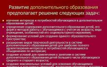
Lesson Objectives:
- to form an idea of the diversity of countries in the modern world; find out the main criteria for classifying countries of the world; give the concept of “sovereign state”, “gross domestic product”, “human development index”; continue to develop skills in working with various sources geographic information and contour maps; find out the significance of the political and geographical location for the country
Equipment: political map of the world, atlases, contour maps
Lesson type: learning new material
DURING THE CLASSES
I. Learning new material.
Today in the lesson we will get acquainted with the stages of formation of the political map of the world, find out the criteria for classifying countries of the world and determine the position of these countries on the political map.
Write down the date and topic of the lesson in your notebook
EXERCISE. While studying the topic, write down the main groups of countries in the world in your notebook.
- What information can you find out using a political map of the world?
Students: Using a political map you can find out the position of countries, their capitals and state borders.
The political map changes over time. There are five stages in the formation of the political map of the world, which reflect the course of development human society:
| Stages | Development of human society |
| Istage- ancient (before 5th century AD) | the rise and fall of states such as Carthage, Ancient Greece, Ancient Rome, Ancient Egypt. |
| IIstage - medieval (5th-16th centuries) | the emergence of large feudal states in Europe and Asia. |
| IIIstage - new (16-19 centuries) | the era of the emergence and establishment of capitalist relations in the world. |
| IVstage - newest | The formation of the political map is associated with the First and Second World Wars. |
| Vstage - modern | the emergence of socialist states in Eastern Europe, Asia and Latin America; collapse of the socialist system; collapse of the USSR, Yugoslavia, Czechoslovakia; unification of the GDR and the Federal Republic of Germany; termination of the Warsaw Pact Organization; gaining independence of a number of states. |
If in 1900 there were 57 sovereign states in the world, then by 2002 out of 230 states there were already 192. The remaining states are non-self-governing territories - mainly “fragments” of former colonial empires Great Britain, France. Netherlands, USA.
QUESTION: Which state is called “sovereign”?
Sovereign State- a politically independent state with independence in external and internal affairs.
Since there are a lot of countries in the world, there is a need to group them, which is carried out on the basis of different quantitative criteria and qualitative indicators. Based on quantitative criteria, the most common grouping of countries is by size (area) of territory (7 countries with a territory of 3 million km² each). Together they make up ½ of the entire landmass.
EXERCISE. By " business card"In the flyleaf of the textbook, write down the seven largest countries by S territory. (Students write in a notebook: Russia, Canada, China, USA, Brazil, Australia, India. We look at the atlas)
In terms of population, there are 11 largest countries, with a population of more than 100 million people in each: China, India, USA, Indonesia, Brazil, Pakistan, Bangladesh, Russia, Japan, Nigeria, Mexico. (The teacher shows the countries on the map, and the students take turns using the atlas to name the capitals).
Countries are often grouped according to the characteristics of their SOEs. They are distinguished: coastal (have access to the sea or ocean), peninsular (located on peninsulas), island (located on islands), archipelagic countries (located on an archipelago), landlocked (do not have access to the sea).
EXERCISE. Give examples of countries in this group. (Students go to the map and show examples of countries in this group).
Based on quality indicators, countries are divided into:
1.Economically developed write down
2.Developing in a notebook
3.Countries with economies in transition
II. Fizminutka
The main criterion for this typology is the level of socio-economic development, which is determined gross domestic product indicator(GDP) is an indicator characterizing the cost of all final products produced in a given country in one year, in US dollars. IN Lately began to be used new indicator socio-economic development of countries around the world –human development index(HDI) - takes into account not only GDP, but also average life expectancy and level of education.
QUESTION: Which countries and regions do you think have the highest HDI?
Students: In the USA, Canada, countries Northern Europe, Japan. (If students make inaccuracies in the names of countries and regions, the teacher helps).
QUESTION: And which countries have the lowest HDI?
Students: The countries in the African region will have the lowest HDI. (Teacher clarifies: Burundi, Sierra Leone, Niger.)
- Russia in this list is at the beginning of the group of countries with an average HDI level.
The UN currently classifies approximately 60 countries in Europe, Asia, Africa, and North America, Australia and Oceania. This group of countries is distinguished by significant internal heterogeneity and four subgroups can be distinguished within its composition.
The developing countries (third world countries) include about 150 countries and territories, which can be divided into six subgroups.
And finally, a group of countries with economies in transition is highlighted. Give students handouts.
Countries with economies in transition: post socialist countries, many of them can be classified as developed countries: Hungary, Poland, Czech Republic, Latvia, Lithuania, Estonia, etc. Russia, Ukraine, China occupy a special place in this group.
EXERCISE(work on contour maps)
Sign the G7 countries to contour map
- Let's remember the definition of political-geographical location (PGL) and determine its role for the country.
Political-geographical location is one of the fundamental concepts in geography, which has a direct impact on the socio-economic development of any country.
III.Reflexion. Name the main groups of countries in the world that you wrote down in your notebook while studying new topic.
Students: Main country groups:
By area
By population
According to the features of the GP
By level of socio-economic development
IV. Homework: learn paragraph 20 answer questions 1-4 orally
subgroups of economically developed countries
The "Big Seven" Western countries: USA, Japan, Germany, France, Great Britain, Italy, Canada - are distinguished by the largest scale of economic and political activity
Smaller countries Western Europe- play big role in world affairs, most of them have the same GDP per capita as the G7 countries
Non-European countries: Australia, New Zealand, South Africa - former settler colonies (dominions) of Great Britain that did not know feudalism. Israel is usually included in this group.
Formed in 1997: Republic of Korea, Singapore, Taiwan - approached other economically developed countries in terms of GDP per capita
subgroups of developing countries
Key countries: India, Brazil, Mexico, China are leaders developing world with great natural, human and economic potential
Countries with per capita GDP exceeding 1-2, and sometimes 5 thousand dollars: Argentina, Uruguay, Venezuela, etc. (Latin America), there are such countries in Asia and North America
Newly industrialized countries (NICs): “Asian tigers” (1st tier: Republic of Korea, Singapore, Taiwan, Hong Kong, which in 1997 became part of China under the name Hong Kong; 2nd tier: Malaysia, Thailand, Indonesia)
Oil exporting countries: Saudi Arabia, Kuwait, United United Arab Emirates, Libya, Brunei, etc.
Those lagging behind in their development, with a per capita GDP of less than 1 thousand dollars per year: some countries in Africa, Asia, Latin America
Least developed countries: about 50 countries with GDP between $50 and $300 per year
The modern political map of the world indicates the geographical location of countries and their political and administrative structure. The main political and geographical changes are reflected: the emergence of new independent states, the change political structure countries, changes in their borders and territories, names of countries and capitals, etc. The political map of the world and the patterns of changes on it are studied by the branch of geography called political geography.
The political map of the world reflects the state structure of countries, their features state system management, relations between states, as well as regional conflicts arising in connection with the definition state borders and population resettlement. The political map of the world is constantly changing. Factors contributing to this:
- wars on various levels;
-deprivation of the country's independence, changing the boundaries of the territory;
-interstate and international agreements;
-formation of new independent states;
-change of the name of the country and capital;
-collapse and unification of states;
-changes in the structure and state system of government of the country;
-moving the capital of the country to another city.
All events related to the formation of the modern political map of the world are conventionally divided into two periods: the new one - from the 17th century to the First World War and the newest - from the First World War to today. Recent period is divided into 4 stages. 1st stage from 1918 to 1945, 2nd stage from 1945 to stage 3rd stage from 1945 to 1985, 4th stage from 1985 to the present.
On the modern political map of the world, there are more than 200 states that have declared their independence. Among them, the number of countries recognized on international level– 191. A number of objects of the modern political map of the world include 67 dependent territories that do not have the status of independent governance.
Test questions
1.What is the name of the branch of geography that studies the political map of the world and the patterns of changes on it?
A) ecology
B) physical geography
C) biology
D) political geography
2.How many independent states are there on the modern political map of the world?
A) 400
B) 300
C) 200
D) 100
3. What 2 periods are all events related to the formation of the modern political map of the world divided into?
A) old and new
B) new and modern
C) new and newest
D) old and newest
2. How many independent territories are there on the modern political map of the world?
A) 27
B) 47
C) 67
D) 87
Glossary
Russian language
Kazakh language
English language
Socio-economic geography
Aleumetik-economics geography
Social-economic geography
Geographical discoveries
Geographical ashular
Geographical openings
Great Travelers
Attacks sayakhatshylar
Great travelers
Research
Zertteuler
Studies
A political map of the World
Daily life maps
Political card of the world
Formation periods
Kalyptas Kezenderi
Periods of the shaping
Independent states
Tauelsiz memleketter
Independent state
Territory
Aumak
Territory
CPC topics
1) Study the topic “Earth as a Planet.” L1, pp. 5-9.
SRSP topics
1) Based on diagram 5, analyze the changes that have taken place on the political map of the world using the example of one state. L1, pp. 78-81.
Geography teacher MOU Secondary School 176
Slide 2
1. Stages of formation of the political map of the world
2. Division of countries:
- by level of socio-economic development
- by territory size
- by population
- By geographical location
- by form of government
- According to territorial features - government system
3. Political geography
Slide 3
Stages of formation of the political map of the world
- Ancient (before the 5th century AD) emergence and collapse of the first states.
- Medieval (V – XVI centuries) – the emergence of large feudal states in Europe and Asia
- New (XVI-XIX centuries) - the formation of a colonial empire.
- The newest (first half of the twentieth century) – the formation of socialist countries, the collapse of the colonial system
- Modern (second half of the 20th century – modern period)
Slide 4
Changes to the map
- Quantitative
- Territorial
- acquisitions, acquisitions
- losses,
- voluntary concessions
- Quality
- change of formations
- conquest of sovereignty
- introduction of a new government system
Slide 5
Level of socio-economic development. Expressed through GDP and HDI
- Economically developed countries
- G7 countries (GDP – 20 – 30 thousand dollars)
- Smaller Western European countries (GDP same as G7 countries)
- Countries of settler capitalism (dominions of Great Britain)
Slide 6
Countries with economies in transition
Former socialist countries:
1. Eastern Europe (Russia, Belarus, Ukraine, Bulgaria...) They can be classified as economically developed countries
2. Post-socialist and socialist countries (Laos, Vietnam..). They can be classified as developing countries
Slide 7
Developing countries
- Key countries have great natural, human and economic potential. GDP $350.
- Countries of Latin America, Asia, North Africa. GDP 1000 dollars.
- NIS – Newly Industrialized Countries – “Asian Tigers”
- Oil exporting countries of the Persian Gulf. GDP 20 - 30 thousand dollars.
- "Classic" developing countries lagging behind in their development, with a per capita GDP of less than 1 thousand dollars per year. Most countries in Africa, as well as Asia and Latin America.
- Least developed countries "fourth world" 47 countries with a GDP of 100 - 300 dollars per year. Ethiopia, Haiti, Bangladesh...
Slide 8
There are more than 200 countries and territories on the PKM, of which more than 190 are sovereign states, among them are:
BY TERRITORY SIZE
- The countries are giants, with an area of more than 3 million. km2 (Russia, Canada, China, USA, Brazil, Australia, India)
- “Large countries”, their area is more than 500 thousand km2 (France, Spain..), their area is more than 1 million. km2 (Sudan, Algeria, Libya..)
- Microstates – having a small San Marino, Liechtenstein, area (Vatican City, Singapore..)
Slide 9
BY POPULATION
- Giant countries with a population of over 100 million people (China, India, USA, Brazil, Indonesia, Russia...)
- Middle countries (Algeria, Mexico...)
3. Small countries, microstates, with a population of 10 - 30 thousand people or less (Vatican City, San Marino, Monaco...)
Slide 10
BY GEOGRAPHICAL POSITION
- With a coastal location (Mexico, Argentina, Congo, Saudi Arabia, Poland, Russia..)
2. Peninsular (Italy, India, Portugal, Korea, Denmark..)
3. Island (Great Britain, Cuba, Iceland, Madagascar, ..)
4. Inland countries (42 states are deprived of access to the ocean: Mongolia, Austria, Czech Republic, Chad, Rwanda...)
Slide 11
By form of government
1. Republic – ¾ of all countries in the world
Slide 12
2. Monarchies
There are 30 of them in the world:
- Oceania 2
- Asia 13
- Africa 3
- Europe 12
Slide 13
3.States within the Commonwealth
- 15 countries, former dominions of Great Britain,
- Formally, the head of state is the Queen of Great Britain, who is represented by the Governor General
Slide 14
4. Represented by Libya alone
- Officially the Socialist People's Libyan Arab Jamaheria (state masses)
Slide 15
According to the characteristics of the territorial government structure
Slide 16
Politicalgeography
- Formation of a political map of the world and its individual regions
- Changes in political boundaries
- Features of the state system
- Political parties, groups and blocs
- Territorial aspects of mass election campaigns
- GEOPOLITICS – expresses public policy primarily in relation to the country's borders and its interaction with others, primarily neighboring countries
Slide 17
Complete the task:
According to form political system countries are:
A) monarchies
B) democracies
B) federations
D) republics
According to the form of the state territorial structure countries are divided into:
A) theocratic
B) totalitarian
C) federal D) unitary
The Commonwealth of Nations is an interstate association headed by:
A) Russia
B) Great Britain
B) France
Slide 18
A) Bolivia D) Hungary
B) Israel D) Mongolia
B) Ukraine E) Mali
- There are total monarchies in the world:
A) 24 B) 30 C) 37 D) 43
- Select countries that have a republican form of government:
A) Austria B) Great Britain B) Mexico D) Türkiye
Select countries that do not have access to open sea:
Slide 19
- This presentation can be used when teaching lessons in the 10th grade in the course “Economic and Social Geography of the World”. When studying the topic “Modern political map of the world.”
- Introduces students to new terms and concepts. Forms ideas and knowledge about modern PCM. Considers the features and stages of the formation of the PCM, presents the main possible criteria for typologizing the countries of the world, forms ideas about the leading criteria for the modern typologization of the countries of the world, forms ideas about geopolitics and political geography.
Public lesson in geography on the topic: Formation of political world maps.
Conducted in 10th grade on February 17, 2015 as part of a seminar for geography teachers “ Modern technologies in teaching geography"
Target:
Consider and systematize the changes that have occurred on the political map of the world;
Tasks:
Educational: - consider the concept of “Political map of the world” in a broad and narrow sense;
- study periods of formation of the political map of the world and their content;
Give a qualitative and quantitative description of the political map of the world;
Introduce the concepts of “country” and “sovereignty”,
Developmental : - improve skills in working with special maps, statistical material and computers, and based on this draw appropriate conclusions and conclusions;
Educational: - continue the formation of communication skills, develop the ability to work in small groups;
Development of the ability to voluntarily fulfill obligations, both personal and based on the requirements of the team; formation of high moral and volitional qualities, necessary habits of behavior.
Planned results:
Subject:
Basic level: define concepts, distinguish between qualitative and quantitative changes on the political map of the world, give examples;
Advanced level: assess the influence of historical events on the formation of the PCM, predict further events on the political map of the world based on current situation using information from modern media;
Create the following UUD:
Personal:
the formation of a person’s geographic culture, expansion of geographical horizons, civil patriotism, the ability to conduct dialogue on the basis of equal relations and mutual respect and acceptance, the willingness and ability to accept the help and opinion of elders.
Regulatory: take into account the action guidelines identified by the teacher in educational material, in collaboration with the teacher, class, find several solutions learning task, adjust your actions in accordance with the changing situation;
Cognitive: to use thematic maps, tables, diagrams, build messages orally, build logical reasoning and draw conclusions, the ability to define concepts; search and selection of necessary information, application of information retrieval methods;
Communication : choose adequate speech means in dialogue with the teacher and classmates; accept other opinions and positions; come to an agreement, come to an agreement general decision, formulate, argue and defend your own opinion;
Educational technology :
research method, group work method.
Equipment: wall maps “Political map of the world”, “Political map of Europe”, political globe, multi-media projector, electronic presentation for the lesson: “Formation of a political map of the world”, additional literature: "All about the countries of the world." Atlas reference book.
Individual equipment : textbook Yu.N. Gladky, V.V. Nikolina, Geography. The modern world: a textbook for grades 10 - 11 of general education organizations, “My simulator” author V.V. Nikolina, Geographical atlas, Cell phones with Internet access, table “Countries that achieved political independence after the Second World War,” emoticons.
Teaching methods : verbal, visual, practical; explanatory - illustrative, partially - search, research, reproductive.
Lesson type: learning new material
Vinakurova Zh.I.: Hello, guys! I decided to start today's lesson with a riddle.
Slide 1
In geography drawing
It looks like a big carpet.
Every country is on it
Visible from end to end.
What it is?
Student answers: political map of the world.
VZHI: Indeed, having studied issues related to culture, civilizations and religions, we came to the section “Political Map of the World”.
Slide 2
The epigraph for today's lesson will be the words:
“The significance of the political map is enormous. The geographical political map really reflects reality: the international situation, the place of countries in modern world. At the same time, it, especially in dynamics, in historical sequence, is the most important document for statesmen, politicians, political scientists and an important tool for research, including in political geography - a branch of economic and social geography"
What information does PCM carry?
Do you agree with all the arguments stated in the epigraph?
What processes does the PCM not reflect?
Students' answers
We also worked with the political map of the world in previous geography courses. What do you think: what questions should we consider in class today? Pay attention to the questions at the beginning of paragraph 20.
Students’ answers: questions of forming a political map of the world, give quantitative and qualitative characteristics political map of the world in order to move on to the study of the main objects of PCM.
Topic of our lesson: Formation of a political map of the world (slide 3 opens)
Slide 4 Today in the lesson we will look at the concept of “political map of the world” in a narrow and broad sense, using knowledge of history, literary sources, consider the periods of formation of the political map of the world, get acquainted with the concepts of “Country” and “Sovereignty”, give a qualitative and quantitative description of the political world map.
For this lesson we will need the Geography textbook. Modern world Gladky, Nikolina, “My simulator” by V.V. Nikolina, geographical atlas, table “Countries that achieved political independence after the Second World War”, additional literature and telephones with Internet access.
Slide 5 (from 5 - 6 images of PCM in different periods)
The diverse natural background of the Earth is complemented by the cultural, historical and socio-economic diversity of countries and peoples. The multiple nature of the state of culture and civilization is reflected in the political map of the world. It includes interrelated objects: geographical (countries, territories) and ethnic (peoples). Therefore, the appearance of the world is always determined by the space where life events take place, the time of their occurrence and the peoples existing in space and time as acting characters in the theater of history. Since we will be talking about the political map, about the stages of its formation, let’s analyze the map and give a definition: what is a “Political Map”?
Students' answers
Slide 6
Political map – 1) in a broad sense – a body of information about the political geography of the world, a set of countries and peoples taken in all the historical complexity of social relations;
2) in a narrow sense - a special map that displays territorially - political division globe.
Vinakurova Zh.I. The modern political map of the world is the result of several millennia of its development. In the process of its formation, several periods are distinguished.
Characteristics of the historical periods of the formation of PCM.
Speech by students on completed advanced tasks:
Slide 5 Ancient period Tamarova T. (working with a map Ancient Egypt+ video clip about Ancient Rome) Centuries and millennia pass, but interest in the history of peoples does not subside.
Slide: 6 Medieval period Tatyanchenko T.
Slide 7: New period: Pozdnyakova A. (map “Great geographical discoveries"and portraits of discoverers)
Slide 8 : The newest period of Gekova changes after World War 2
(map of changes after World War I)
Slide 9: Modern period Rukin N.
VZHI: What changes do you think are possible in PCM in the next 50 years?
Students' answers
Collage of photos: world wars, “hot spots”, etc.
Using the text of paragraph 5 of the textbook, additional literature and Internet resources, complete task No. 2 on p. 18 in “My simulator”, authors Yu.N. Gladky, V.V. Nikolina.
Upon completion of the work, students name the features of the formation of the political map of the world of each era.
Alexander Ukraichenko Read by student Anikeev A.
A political map of the World
A hundred years ago the world was different
Take a look at the map:
The colonies disappeared like smoke,
And the states became sovereign.
Having changed the world, he does not stand still,
Borders move back and forth.
There are now over two hundred countries in the world,
Their net is always changing.
Next we will work in groups. Since there are 8 people in the class, we will have 2 groups. Each group selects the proposed tasks and works on them. You can use all the equipment and phones you have to access the Internet.
Slide 7
Group 1 tasks: Printed for group
Working with the table “Countries that achieved political independence after the Second World War” and the political map of the world
Answer the questions:
- What year can be called the year of Africa. Why?
- A characteristic feature of the Political Map of the World after the Second World War is the collapse of the colonial system and the emergence of dozens of liberated countries. Specify the part of the world with the largest number countries that achieved political independence during this period.
Group 2 task: Printed for the group
1. Working with the table “Countries that achieved political independence after the Second World War”, political and contour maps of the world, answer the questions:
1.What unites the following countries: Mali, Cambodia, Gabon?
A) These countries are single-national;
B) These are former colonies of France;
B) have access to the Indian Ocean.
2.Place on a contour map the states of Oceania that achieved political independence in 1986.
Group presentations on proposed issues.
Slide 8. When characterizing these changes on the PCM, it is appropriate to explain the concepts: “country” and “sovereignty”. Try to find definitions of these concepts yourself using phones with Internet access and dictionaries. One person is working with a laptop.
A country- in political and geographical terms - a territory that has certain boundaries, enjoys state sovereignty or is under the authority of another state.
Sovereignty– independence of the state in external or internal affairs; basic principle of modern international law and international relations.
Today we will get acquainted with the qualitative and quantitative changes taking place on the political map of the world.
Slide 9
Analysis of Fig. 31 on p. 88. Name quantitative changes and give examples.
Students' answers.
Name the qualitative changes on the political map of the world and give examples.
Students' answers.
Our lesson is coming to an end. Let's do a few tasks to reinforce the material.
Slide 10
Determine in which cases we are talking about qualitative changes on the political map of the world, and in which cases – about quantitative ones?
In 1990 Yemen Arab Republic PDRY united in single state- Republic of Yemen.
According to the Institute of Marine Geology and Geophysics, Far Eastern Branch of the Russian Academy of Sciences, as a result of the earthquake in Nevelsk on August 2, 2007, the seabed rose and a land area with a total area of 3 km2 was formed. To the formation of another plot of 1.5 km2CAUSED BY THE VUL ERUPTIONKANA Sarychev Peak on the Kuril Island of Matua in June 2009.
In 1993, the new state of Eritrea (a former province of Ethiopia on the Red Sea) emerged.
Part of the territory of the Netherlands is land reclaimed from the sea, which led to a change in the political map of the country.
Slide 11 Which region on the PKM was affected the least by the changes, and can it be considered the most stable region on the PKM?
Slide 12. Which region is richest in the formation of new states?
Students' answers.
Slide 13 Barents Sea
On September 15, 2010, the President of the Russian Federation and the Prime Minister of Norway signed an agreement on the delimitation of jurisdictional zones in the Barents Sea.
Photo. What changes are we talking about?
Conclusion: PCM is characterized by high dynamism. It reflects the main political and geographical changes, the formation of new independent states, the merger of one state with another, changes in the area of the state, capitals and much more. All these elements make up the main content of the political map of the world.
Reflection:
Self-esteem.
Guys, each of you is asked to fill out a table where you must evaluate your work in class.
|
My grade for work in class |
What did I learn? |
What have I learned? |
What are your assessments, what have you learned, what are you still struggling with?
If you were now texting a friend about an event, what emoji would you put at the end?
Students raise emoticons.
Today we looked at the stages of PCM formation, worked with different sources information, drew conclusions, worked on assignments. You worked actively throughout the lesson. Write down your homework.
Slide14
Item 20 and for students who want to get a higher grade, I suggest completing task No. 9 on p. 89.
Slide 15
Thank you for your attention


"pros" and "cons" of democracy
Surveyor. Who is a surveyor? Description of the profession. Profession surveyor Surveyor training
Magellanic clouds: who are they?
Pepper Steak Sauce Creamy Pepper Sauce
How to create a competent portfolio for a designer